
1961 Map of Wimbledon NE
USGS Topo · Published 1963About this map
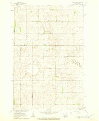
The Griggs Co Barnes Co boundary line runs through this prairie landscape, where the township structure of eastern North Dakota is clearly defined by rural sections and civil townships. Sparse but essential community infrastructure is visible, including the Pierce Sch and Laketown Sch, serving the surrounding agricultural lands. The topography is characterized by a high density of small depressions and seasonal water bodies typical of the glaciated plains, interrupted occasionally by industrial activity such as the Gravel Pits in the northeast. The map provides a detailed view of the township divisions, including Dover, Bartley, Pierce, Laketown, Uxbridge, and Edna. Many of these township names and school locations represent the core of local rural identity during the early 1960s, a period when small country schools were still prominent landmarks on the North Dakota prairie.
Find a feature on this map
10 named features on this map. Tap any name to fly to it.
Don’t see what you’re looking for? This feature index may not catch every label — zoom into the map to look around manually.
Map Details
Editions of this 1961 Wimbledon NE Map
This is the sole edition of this map. No revisions or reprints were ever made.
Other maps of this area

1952 · New Rockford
USGS Topo · 1:250,000

1956 · New Rockford
USGS Topo · 1:250,000

1961 · Leal
USGS Topo · 1:24,000

1961 · Revere
USGS Topo · 1:24,000

1961 · Wimbledon
USGS Topo · 1:24,000

1961 · Hannaford
USGS Topo · 1:24,000

1961 · Rogers
USGS Topo · 1:24,000
1961 · Sutton SW
USGS Topo · 1:24,000

1961 · Dazey
USGS Topo · 1:24,000
1970 · Clementsville
USGS Topo · 1:24,000