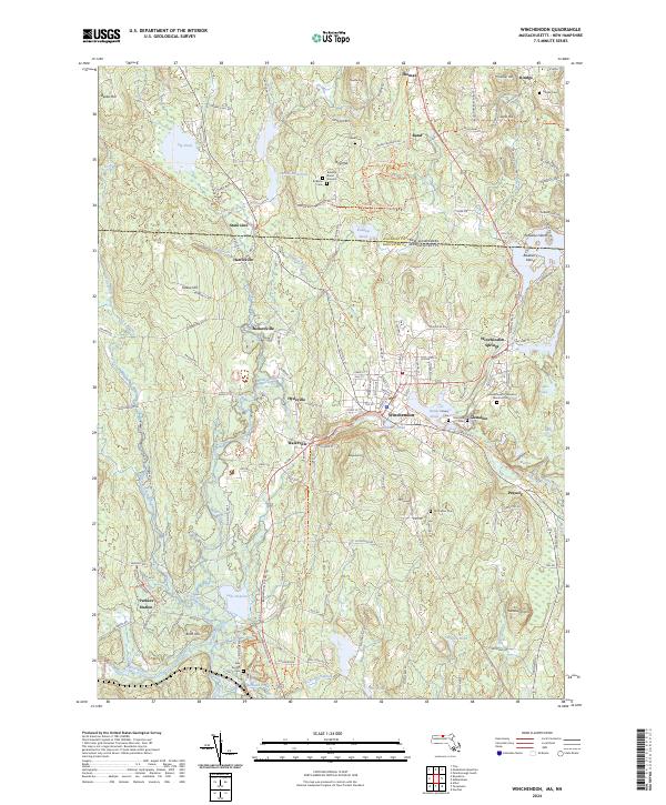
2024 Map of Winchendon
USGS Topo · Published 2024About this map
Winchendon sits at the heart of this landscape where the Millers River and its tributaries once powered the local economy. The transition from industrial rail corridors to modern usage is evident in the Cheshire Rec Rail Trail and Monadnock-Rec Rail Trl, which follow the historic paths of the region's railroads. Settlement patterns are dense around the established hubs of Winchendon Springs, Waterville, and Hydeville, while the surrounding terrain is marked by numerous water bodies like Sip Pond and Lake Denison.
Find a feature on this map
161 named features on this map. Tap any name to fly to it.
Don’t see what you’re looking for? This feature index may not catch every label — zoom into the map to look around manually.
Map Details
Editions of this 2024 Winchendon Map
This is the sole edition of this map. No revisions or reprints were ever made.
Other maps of this area

1887 · Winchendon
USGS Topo · 1:62,500

1887 · Fitchburg
USGS Topo · 1:62,500

1889 · Fitchburg
USGS Topo · 1:62,500

1890 · Winchendon
USGS Topo · 1:62,500

1893 · Fitchburg
USGS Topo · 1:62,500

1894 · Winchendon
USGS Topo · 1:62,500

1898 · Monadnock
USGS Topo · 1:62,500

1900 · Peterboro
USGS Topo · 1:62,500

1931 · Fitchburg
USGS Topo · 1:48,000

1932 · Winchendon
USGS Topo · 1:48,000