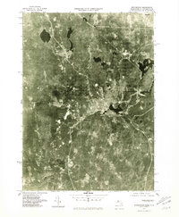
1975 Map of Winchendon
USGS Topo · Published 1981About this map
The Commonwealth of Massachusetts Department of Public Works and the USGS produced this orthophotoquad capturing the industrial and residential core of Worcester County in the mid-1970s. The image-based map centers on the manufacturing legacy of Winchendon, where the concentrated density of the town center contrasts with the surrounding wooded tracts and water bodies. The Millers River and Otter River cut through the landscape, historically powering the mills that defined local settlements like Waterville and Winchendon Springs. To the north, the New Hampshire border is clearly visible at State Line and near the town of Rindge, while the large expanse of Lake Monomonac dominates the northeastern corner. This specialized format allows researchers to see exact building footprints, clearings, and shoreline conditions as they existed before modern suburban expansion.
Find a feature on this map
9 named features on this map. Tap any name to fly to it.
Don’t see what you’re looking for? This feature index may not catch every label — zoom into the map to look around manually.
Map Details
Editions of this 1975 Winchendon Map
This is the sole edition of this map. No revisions or reprints were ever made.
Other maps of this area

1887 · Winchendon
USGS Topo · 1:62,500

1887 · Fitchburg
USGS Topo · 1:62,500

1889 · Fitchburg
USGS Topo · 1:62,500

1890 · Winchendon
USGS Topo · 1:62,500

1893 · Fitchburg
USGS Topo · 1:62,500

1894 · Winchendon
USGS Topo · 1:62,500

1898 · Monadnock
USGS Topo · 1:62,500

1900 · Peterboro
USGS Topo · 1:62,500

1931 · Fitchburg
USGS Topo · 1:48,000

1932 · Winchendon
USGS Topo · 1:48,000