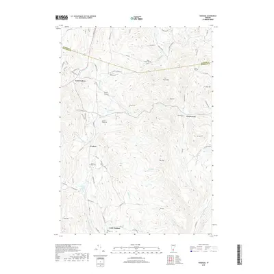
2018 Map of Windham
USGS Topo · Published 2018About this map
Windham and its surrounding hamlets occupy a high-relief landscape where the headwaters of the Saxtons River and the Middle Br Williams River carve through the Green Mountains. The settlement pattern remains oriented around historically significant village centers like Houghtonville and South Windham, each maintaining its own distinct burial ground, such as the Windham Center Cem and Stiles Cem. The curiously named Popple Dungeon area, with its own Popple Dungeon Cem, highlights the isolated character of these upland drainages.
Find a feature on this map
79 named features on this map. Tap any name to fly to it.
Don’t see what you’re looking for? This feature index may not catch every label — zoom into the map to look around manually.
Map Details
Editions of this 2018 Windham Map
This is the sole edition of this map. No revisions or reprints were ever made.
Other maps of this area

1893 · Wallingford
USGS Topo · 1:62,500

1894 · Londonderry
USGS Topo · 1:62,500

1899 · Londonderry
USGS Topo · 1:62,500

1928 · Ludlow
USGS Topo · 1:48,000

1929 · Ludlow
USGS Topo · 1:62,500

1930 · Saxtons River
USGS Topo · 1:48,000

1932 · Ludlow
USGS Topo · 1:62,500

1933 · Saxtons River
USGS Topo · 1:62,500

1950 · Glens Falls
USGS Topo · 1:250,000

1955 · Wallingford
USGS Topo · 1:62,500