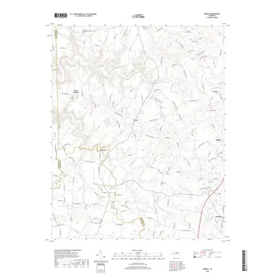
2019 Map of Windle
USGS Topo · Published 2019About this map
Hardy and Poplar Springs anchor this landscape along the complex boundary lines of Overton, Jackson, and Putnam counties. The terrain is defined by the winding course of the Roaring River and its numerous tributaries, including Buffalo Br, Flat Br, and Spring Creek. This 2019 survey shows a region heavily populated with community landmarks, particularly family and church cemeteries such as Allen Chapel Cem, Franklin Cem, and Warren Cem. The settlement pattern at Waterloo and Windle reflects the enduring rural character of the Highland Rim, where many small clusters of homes are connected by family-named roads like Jake Davis Rd and Lonnie Nelson Ln. The southern reach of the map transitions into Rickman, showing the more concentrated development near Mason Lake.
Find a feature on this map
146 named features on this map. Tap any name to fly to it.
Don’t see what you’re looking for? This feature index may not catch every label — zoom into the map to look around manually.
Map Details
Editions of this 2019 Windle Map
This is the sole edition of this map. No revisions or reprints were ever made.
Other maps of this area

1897 · Standingstone
USGS Topo · 1:125,000

1898 · Standingstone
USGS Topo · 1:125,000

1925 · Gainesboro
USGS Topo · 1:62,500

1929 · Gainesboro
USGS Topo · 1:62,500

1943 · Cookeville
USGS Topo · 1:100,000

1944 · Cookeville
USGS Topo · 1:100,000

1944 · Livingston
USGS Topo · 1:24,000

1951 · Windle
USGS Topo · 1:24,000

1953 · Cookeville East
USGS Topo · 1:24,000

1953 · Cookeville West
USGS Topo · 1:24,000