
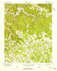
1951 Map of Windle
USGS Topo · Published 1989About this map
Roaring River and Spring Creek carve a complex system of valleys through this portion of Overton County, defining the early settlement patterns of the 1950s. The landscape is dotted with small rural hubs and community landmarks, ranging from the crossroads at Rickman to the scattered settlements of Windle and Waterloo. Local life at mid-century is anchored by numerous country churches and schools, such as Mt Gilead Ch, Dodson Chapel, and Oneal Sch.
Find a feature on this map
55 named features on this map. Tap any name to fly to it.
Don’t see what you’re looking for? This feature index may not catch every label — zoom into the map to look around manually.
Map Details
Editions of this 1951 Windle Map
This is the sole edition of this map. No revisions or reprints were ever made.
Other maps of this area

1897 · Standingstone
USGS Topo · 1:125,000

1898 · Standingstone
USGS Topo · 1:125,000

1925 · Gainesboro
USGS Topo · 1:62,500

1929 · Gainesboro
USGS Topo · 1:62,500

1943 · Cookeville
USGS Topo · 1:100,000

1944 · Cookeville
USGS Topo · 1:100,000

1944 · Livingston
USGS Topo · 1:24,000

1953 · Cookeville East
USGS Topo · 1:24,000

1953 · Cookeville West
USGS Topo · 1:24,000
1955 · Hilham
USGS Topo · 1:24,000