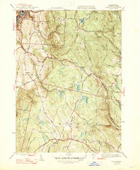
1947 Map of Windsor
USGS Topo · Published 1947About this map
Weston Mountain and the surrounding Hoosac Range dominate this mid-century landscape in the Berkshires, where the transition from industrial Adams to the rural uplands is clearly defined. The terrain is marked by numerous watercourses including the Chickley River and Westfield River, which flow through deeply carved valleys alongside old thoroughfares like Steep Bank Road and Windsor Road.
Find a feature on this map
66 named features on this map. Tap any name to fly to it.
Don’t see what you’re looking for? This feature index may not catch every label — zoom into the map to look around manually.
Map Details
Editions of this 1947 Windsor Map
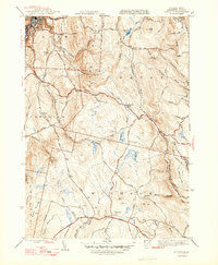
2 editions found
Other maps of this area

1886 · Greylock
USGS Topo · 1:62,500

1886 · Hawley
USGS Topo · 1:62,500

1886 · Chesterfield
USGS Topo · 1:62,500

1886 · Becket
USGS Topo · 1:62,500

1888 · Becket
USGS Topo · 1:62,500

1888 · Chesterfield
USGS Topo · 1:62,500

1890 · Hawley
USGS Topo · 1:62,500

1891 · Greylock
USGS Topo · 1:62,500

1893 · Chesterfield
USGS Topo · 1:62,500

1893 · Becket
USGS Topo · 1:62,500