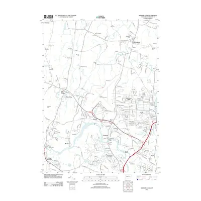
2012 Map of Windsor Locks
USGS Topo · Published 2012About this map
Bradley International Airport dominates the central landscape of this 2012 survey, illustrating the modern aviation infrastructure that defines much of the area today. The Farmington River winds through the southern half of the quadrangle, passing through historic settlements such as Poquonock, Rainbow, and Spoonville. The map's geographic record is particularly valuable for its documentation of early burial sites, including the uniquely named Ye Olde Poquonock Burial Grounds and several community cemeteries like Suffield Cem and East Granby Cem. Residential developments and traditional village centers are interspersed with elevated terrain like Peak Mountain and Meeting House Hill, showing a complex mix of suburban growth and preserved history. Other notable points of interest include the Windsor Locks Reservoir and local landmarks such as Bull Run Corner and Hathaway Hollow.
Find a feature on this map
265 named features on this map. Tap any name to fly to it.
Don’t see what you’re looking for? This feature index may not catch every label — zoom into the map to look around manually.
Map Details
Editions of this 2012 Windsor Locks Map
This is the sole edition of this map. No revisions or reprints were ever made.
Other maps of this area

1886 · Springfield
USGS Topo · 1:62,500

1887 · Granville
USGS Topo · 1:62,500

1889 · Springfield
USGS Topo · 1:62,500

1889 · Granville
USGS Topo · 1:62,500

1892 · Hartford
USGS Topo · 1:62,500

1892 · Granby
USGS Topo · 1:62,500

1893 · Springfield
USGS Topo · 1:62,500

1893 · Granville
USGS Topo · 1:62,500

1895 · Springfield
USGS Topo · 1:62,500

1895 · Granville
USGS Topo · 1:62,500