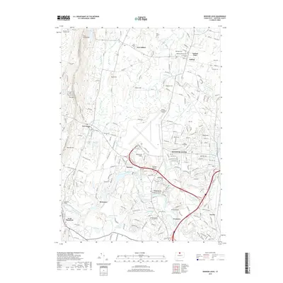
2018 Map of Windsor Locks
USGS Topo · Published 2018About this map
Bradley International Airport anchors the center of this Connecticut landscape, surrounded by the established settlements of Windsor Locks, Suffield, and East Granby. The geography is defined by the sharp rise of Metacomet Ridge and the winding course of the Farmington River, which passes under the Spoonville Bridge near Birchwood. For genealogists and local historians, the area is notably dense with burial sites, ranging from the Ye Olde Poquonock Burial Grounds to the uniquely named Captain John Viets Cem Prisoners Cem near Peak Mountain. Small ponds and brooks, such as Olds and Whipple Pond and Stony Brook, provide a detailed view of the local drainage patterns that shaped the early industrial and agricultural development of these Hartford County towns.
Find a feature on this map
224 named features on this map. Tap any name to fly to it.
Don’t see what you’re looking for? This feature index may not catch every label — zoom into the map to look around manually.
Map Details
Editions of this 2018 Windsor Locks Map
This is the sole edition of this map. No revisions or reprints were ever made.
Other maps of this area

1886 · Springfield
USGS Topo · 1:62,500

1887 · Granville
USGS Topo · 1:62,500

1889 · Springfield
USGS Topo · 1:62,500

1889 · Granville
USGS Topo · 1:62,500

1892 · Hartford
USGS Topo · 1:62,500

1892 · Granby
USGS Topo · 1:62,500

1893 · Springfield
USGS Topo · 1:62,500

1893 · Granville
USGS Topo · 1:62,500

1895 · Springfield
USGS Topo · 1:62,500

1895 · Granville
USGS Topo · 1:62,500