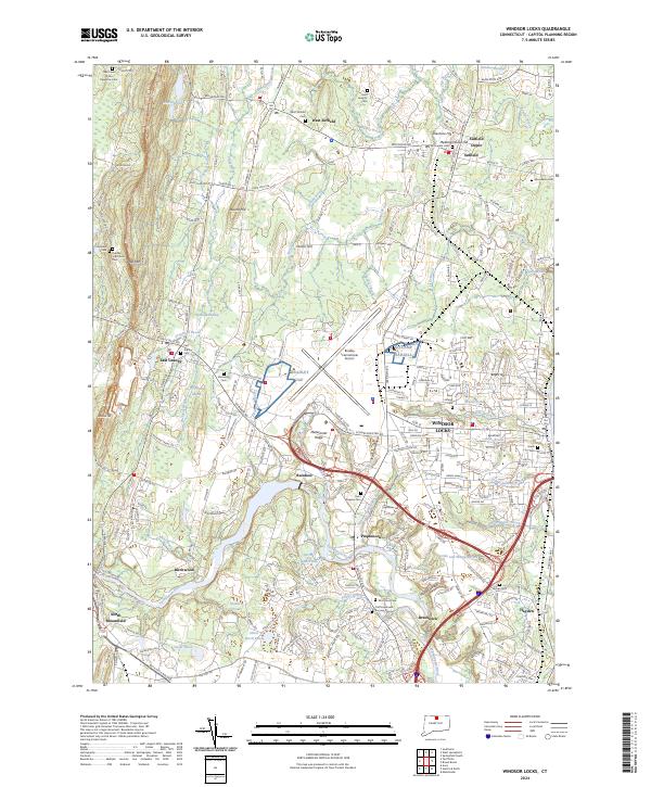
2024 Map of Windsor Locks
USGS Topo · Published 2024About this map
Windsor Locks and the surrounding Hartford County landscape are defined by the convergence of the Lower Farmington River and Salmon Brook and the prominent rising spine of the Metacomet Ridge. This modern survey reveals a complex mix of deep-rooted Connecticut history and major transportation infrastructure, centered on Bradley International Airport. Genealogists and local historians can locate numerous burial sites, from the Old Poquonock Burying Ground near the river to the Captain John Viets Cem and the Prisoners Cem further west. The map documents the continued presence of established neighborhoods like West Suffield, Poquonock, and East Granby, alongside landmarks such as Camp Hartel and the New England National Scenic Trail. The drainage patterns of Phelps Brook and Muddy Brook highlight the area's geography, providing a clear view of how development has integrated with the natural wetlands and ridges of north-central Connecticut.
Find a feature on this map
173 named features on this map. Tap any name to fly to it.
Don’t see what you’re looking for? This feature index may not catch every label — zoom into the map to look around manually.
Map Details
Editions of this 2024 Windsor Locks Map
This is the sole edition of this map. No revisions or reprints were ever made.
Other maps of this area

1886 · Springfield
USGS Topo · 1:62,500

1887 · Granville
USGS Topo · 1:62,500

1889 · Springfield
USGS Topo · 1:62,500

1889 · Granville
USGS Topo · 1:62,500

1892 · Hartford
USGS Topo · 1:62,500

1892 · Granby
USGS Topo · 1:62,500

1893 · Springfield
USGS Topo · 1:62,500

1893 · Granville
USGS Topo · 1:62,500

1895 · Springfield
USGS Topo · 1:62,500

1895 · Granville
USGS Topo · 1:62,500