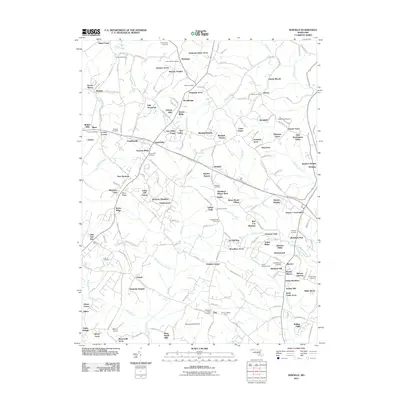
2011 Map of Winfield
USGS Topo · Published 2011About this map
Sams Creek and its many tributaries, including Morgan Run and Gillis Falls, define the rolling drainage patterns of this Carroll County landscape. The map reveals a high density of rural burial grounds, such as Bethel Cemetery, Saint James Cemetery, and Morgans Chapel Cemetery, which provide critical reference points for local genealogy. The settlement pattern is characterized by established centers like Taylorsville and Winfield alongside a newer proliferation of named residential clusters including Stanton Heights, Poignant Acres, and Woodbridge. A legacy of agricultural and early industrial activity is etched into the road network, with routes like Old Liberty Rd and Buffalo Rd connecting the historic crossroads. The presence of specialized sites like White Turf Farm and Camp Fartherest Out indicates the diverse modern land use that has evolved from the area's traditional rural roots.
Find a feature on this map
195 named features on this map. Tap any name to fly to it.
Don’t see what you’re looking for? This feature index may not catch every label — zoom into the map to look around manually.
Map Details
Editions of this 2011 Winfield Map
This is the sole edition of this map. No revisions or reprints were ever made.
Other maps of this area

1892 · Ellicott
USGS Topo · 1:62,500

1893 · Frederick
USGS Topo · 1:125,000

1894 · Ellicott
USGS Topo · 1:62,500

1894 · Frederick
USGS Topo · 1:125,000

1905 · Westminster
USGS Topo · 1:62,500

1906 · Ellicott
USGS Topo · 1:62,500

1908 · Patapsco
USGS Topo · 1:125,000

1909 · Mount Airy
USGS Topo · 1:62,500

1911 · Taneytown
USGS Topo · 1:62,500

1942 · Gettysburg
USGS Topo · 1:125,000