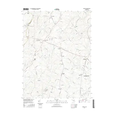
2016 Map of Winfield
USGS Topo · Published 2016About this map
Parrs Ridge and Timber Ridge define the rolling agricultural and residential landscape of this Carroll County region during the mid-2010s. The map illustrates a network of established crossroads and small communities, from the larger hub of Eldersburg in the southeast to historic points like Taylorsville, Winfield, and Franklinville. A high density of rural burial sites, such as Saint James Cem, Bethany Cem, and Shiloh Cem, provides valuable data for genealogical researchers tracing families across the Maryland countryside. The area's connection to regional aviation is evident through several landing strips, including Clearview Airpark, Walters Airport, and Woodbine Airport. Waterways like Gillis Falls, Piney Run, and Sams Cr carve through the terrain, with recreation areas like the Gillis Ridge Trail and Creekside Trail highlighting the preservation of open space amidst the region's steady development.
Find a feature on this map
158 named features on this map. Tap any name to fly to it.
Don’t see what you’re looking for? This feature index may not catch every label — zoom into the map to look around manually.
Map Details
Editions of this 2016 Winfield Map
This is the sole edition of this map. No revisions or reprints were ever made.
Other maps of this area

1892 · Ellicott
USGS Topo · 1:62,500

1893 · Frederick
USGS Topo · 1:125,000

1894 · Ellicott
USGS Topo · 1:62,500

1894 · Frederick
USGS Topo · 1:125,000

1905 · Westminster
USGS Topo · 1:62,500

1906 · Ellicott
USGS Topo · 1:62,500

1908 · Patapsco
USGS Topo · 1:125,000

1909 · Mount Airy
USGS Topo · 1:62,500

1911 · Taneytown
USGS Topo · 1:62,500

1942 · Gettysburg
USGS Topo · 1:125,000