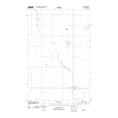
2011 Map of Wing
USGS Topo · Published 2011About this map
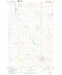
The town of Wing serves as the primary hub in this prairie landscape, where the grid-like organization of Burleigh County is punctuated by numerous glacial depressions and wetlands. The central economy is tied to the land, evidenced by the Patterson Hereford Ranch Landing Field north of town, indicating the scale of regional ranching operations. To the south and east of Haystack Butte, the terrain is defined by a series of significant water bodies including Mitchell Lake, Lonetree Lake, and Camel Slough. These features, along with O'Brien Lake in the northwest, highlight the importance of water management and natural drainage in a region dominated by agricultural sections and established county roads like Railroad Ave and Hill St.
Find a feature on this map
26 named features on this map. Tap any name to fly to it.
Don’t see what you’re looking for? This feature index may not catch every label — zoom into the map to look around manually.
Map Details
Editions of this 2011 Wing Map
This is the sole edition of this map. No revisions or reprints were ever made.
Other maps of this area

1954 · McClusky
USGS Topo · 1:250,000

1958 · McClusky
USGS Topo · 1:250,000

1960 · Horse Lake
USGS Topo · 1:24,000

1960 · Florence Lake
USGS Topo · 1:24,000

1975 · Wing SE
USGS Topo · 1:24,000
1975 · Wing SW
USGS Topo · 1:24,000
1978 · Goodrich SW
USGS Topo · 1:24,000
1979 · Harriet Lake
USGS Topo · 1:24,000

1979 · Canfield Lake
USGS Topo · 1:24,000
1979 · Wing
USGS Topo · 1:24,000