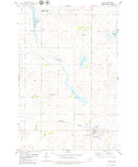
1979 Map of Wing
USGS Topo · Published 1979About this map
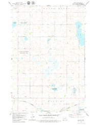
Wing anchors the southern portion of this northern prairie landscape, situated along the Burlington Northern railroad. The geography is defined by a dense concentration of wetlands and water bodies, including Mitchell Lake, Camel Slough, and Lonetree Lake, reflecting the region's importance for wildlife conservation. Significant land is dedicated to the Bunker Lake State Game Management Area and the National Waterfowl Production Area, highlighting the intersection of local agriculture and natural resource management. Elevated terrain such as Haystack Butte and Rock Hill provide orientation points amidst the complex hydrology of Bunker Lake and Horseshoe Lake. Small-scale infrastructure like the Patterson Landing Field and a Boat Ramp on Mitchell Lake indicate the area's utility for both light aviation and local recreation during the late 1970s.
Find a feature on this map
20 named features on this map. Tap any name to fly to it.
Don’t see what you’re looking for? This feature index may not catch every label — zoom into the map to look around manually.
Map Details
Editions of this 1979 Wing Map
This is the sole edition of this map. No revisions or reprints were ever made.
Other maps of this area

1954 · McClusky
USGS Topo · 1:250,000

1958 · McClusky
USGS Topo · 1:250,000

1960 · Horse Lake
USGS Topo · 1:24,000

1960 · Florence Lake
USGS Topo · 1:24,000

1975 · Wing SE
USGS Topo · 1:24,000
1975 · Wing SW
USGS Topo · 1:24,000
1978 · Goodrich SW
USGS Topo · 1:24,000
1979 · Harriet Lake
USGS Topo · 1:24,000

1979 · Canfield Lake
USGS Topo · 1:24,000
1979 · Arena
USGS Topo · 1:24,000