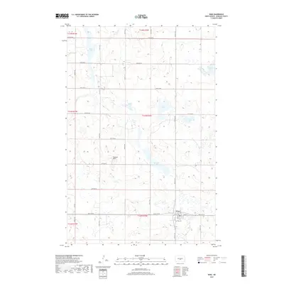
2018 Map of Wing
USGS Topo · Published 2018About this map
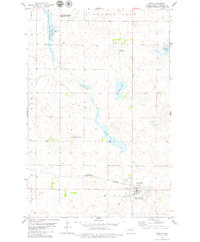
Wing stands as the primary hub of this North Dakota prairie landscape, situated near the southern boundary of the quadrangle. The township is characterized by a grid of rural routes such as 305th Ave NE and 314th St NE, which service a territory defined by glacial potholes and varied wetlands. These water features, including Mitchell Lake, Lonetree Lake, and the winding Camel Slough, dominate the central and northern sections of the map, illustrating the post-glacial drainage patterns typical of the region. Haystack Butte provides a rare point of elevation amidst the low-lying basins. Genealogists and local historians can find the Wing Cem located just east of the main town site, offering a specific point of reference for families rooted in this part of Burleigh County. The surrounding land divisions, such as t143n r76w, document the enduring legal framework of the northern Great Plains.
Find a feature on this map
32 named features on this map. Tap any name to fly to it.
Don’t see what you’re looking for? This feature index may not catch every label — zoom into the map to look around manually.
Map Details
Editions of this 2018 Wing Map
This is the sole edition of this map. No revisions or reprints were ever made.
Other maps of this area

1954 · McClusky
USGS Topo · 1:250,000

1958 · McClusky
USGS Topo · 1:250,000

1960 · Horse Lake
USGS Topo · 1:24,000

1960 · Florence Lake
USGS Topo · 1:24,000

1975 · Wing SE
USGS Topo · 1:24,000
1975 · Wing SW
USGS Topo · 1:24,000
1978 · Goodrich SW
USGS Topo · 1:24,000
1979 · Harriet Lake
USGS Topo · 1:24,000

1979 · Canfield Lake
USGS Topo · 1:24,000
1979 · Wing
USGS Topo · 1:24,000