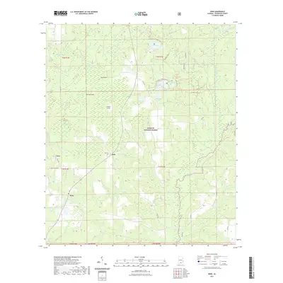
2021 Map of Wing
USGS Topo · Published 2021About this map
Conecuh National Forest dominates this section of southern Alabama, where a network of wetlands and named ponds defines the landscape. The small settlements of Falco, Beda, and Wing serve as local hubs, connected by winding forest routes and county roads. The terrain is notably aquatic, featuring a dense collection of water bodies like Blue Lake, Open Pond, and Ditch Pond, alongside the winding course of the Yellow River. In the swampy reaches of Blackwater Cr, unusual landforms such as Dans Island, Burman Island, and Lenhart Island emerge from the low-lying marshes.
Find a feature on this map
54 named features on this map. Tap any name to fly to it.
Don’t see what you’re looking for? This feature index may not catch every label — zoom into the map to look around manually.
Map Details
Editions of this 2021 Wing Map
This is the sole edition of this map. No revisions or reprints were ever made.
Other maps of this area

1949 · Crestview
USGS Topo · 1:62,500

1949 · Laurel Hill
USGS Topo · 1:62,500

1950 · Laurel Hill
USGS Topo · 1:62,500

1951 · Crestview
USGS Topo · 1:62,500

1953 · Andalusia
USGS Topo · 1:250,000

1957 · Andalusia
USGS Topo · 1:250,000

1957 · Pensacola
USGS Topo · 1:250,000

1959 · Pensacola
USGS Topo · 1:250,000

1960 · Pensacola
USGS Topo · 1:250,000

1971 · Dixie
USGS Topo · 1:24,000