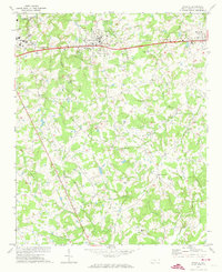
1970 Map of Wingate
USGS Topo · Published 1973About this map
Wingate centers this Union County landscape as it appeared in the early 1970s, defined by the prominent campus of Wingate College and the vital corridor of the Seaboard Coast Line railroad. The map reveals a transition from the developing eastern edge of Monroe to the agrarian communities of the interior, characterized by a dense network of country roads connecting local landmarks. Rural life is anchored by numerous spiritual and educational centers, including Nicey Grove Ch, Tabernacle, and Flag Ch. The terrain is intricately drained by a series of creeks such as Lanes Creek and Meadow Branch, while smaller settlements like Rock Rest and Allens Crossroads indicate the historical importance of local intersections and neighborhood gathering points in this Piedmont region.
Find a feature on this map
40 named features on this map. Tap any name to fly to it.
Don’t see what you’re looking for? This feature index may not catch every label — zoom into the map to look around manually.
Map Details
Editions of this 1970 Wingate Map
2 editions found
Other maps of this area

1941 · Charlotte
USGS Topo · 1:125,000

1941 · Spartanburg
USGS Topo · 1:250,000

1942 · Charlotte
USGS Topo · 1:125,000

1953 · Spartanburg
USGS Topo · 1:250,000

1953 · Charlotte
USGS Topo · 1:250,000

1954 · Charlotte
USGS Topo · 1:250,000

1960 · Charlotte
USGS Topo · 1:250,000

1960 · Spartanburg
USGS Topo · 1:250,000

1962 · Charlotte
USGS Topo · 1:250,000

1963 · Spartanburg
USGS Topo · 1:250,000