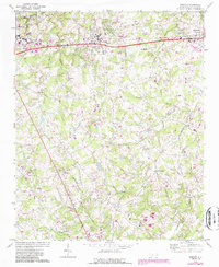
1970 Map of Wingate
USGS Topo · Published 1988About this map
The Seaboard Coast Line corridor anchors the settlement patterns of central Union County, North Carolina, as seen in this 1970 study. The town of Wingate serves as a primary hub, notable for the campus of Wingate College and the neighboring Athletic Field. To the west, the eastern edge of Monroe begins to appear, while the eastern map border reaches Marshville. The rural landscape between these centers is characterized by numerous small communities and crossroads, such as Rock Rest and Allens Crossroads.
Find a feature on this map
43 named features on this map. Tap any name to fly to it.
Don’t see what you’re looking for? This feature index may not catch every label — zoom into the map to look around manually.
Map Details
Editions of this 1970 Wingate Map
2 editions found
Other maps of this area

1941 · Charlotte
USGS Topo · 1:125,000

1941 · Spartanburg
USGS Topo · 1:250,000

1942 · Charlotte
USGS Topo · 1:125,000

1953 · Spartanburg
USGS Topo · 1:250,000

1953 · Charlotte
USGS Topo · 1:250,000

1954 · Charlotte
USGS Topo · 1:250,000

1960 · Charlotte
USGS Topo · 1:250,000

1960 · Spartanburg
USGS Topo · 1:250,000

1962 · Charlotte
USGS Topo · 1:250,000

1963 · Spartanburg
USGS Topo · 1:250,000