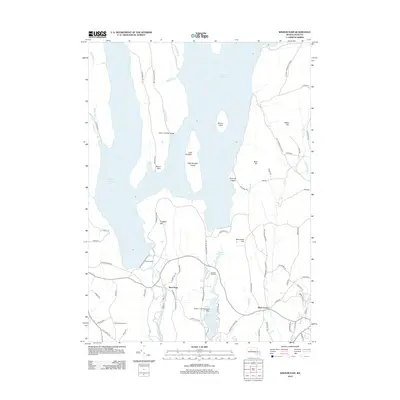
2012 Map of Winsor Dam
USGS Topo · Published 2012About this map
Winsor Dam stands as the primary structural landmark of this landscape, holding back the southern reach of the Quabbin Reservoir. The terrain reflects the massive mid-20th-century engineering of the area, where former valleys were submerged, leaving prominent elevations like Little Quabbin and Mount Lizzie as overlooks or islands. South of the dam, the Swift River continues its course past West Ware, while the surrounding road network, including the Monson Turnpike Rd and Old Ware-Enfield Rd, hints at historical transit routes that predated the reservoir's creation.
Find a feature on this map
82 named features on this map. Tap any name to fly to it.
Don’t see what you’re looking for? This feature index may not catch every label — zoom into the map to look around manually.
Map Details
Editions of this 2012 Winsor Dam Map
This is the sole edition of this map. No revisions or reprints were ever made.
Other maps of this area

1887 · Brookfield
USGS Topo · 1:62,500

1887 · Palmer
USGS Topo · 1:62,500

1887 · Belchertown
USGS Topo · 1:62,500

1887 · Barre
USGS Topo · 1:62,500

1889 · Palmer
USGS Topo · 1:62,500

1889 · Barre
USGS Topo · 1:62,500

1890 · Belchertown
USGS Topo · 1:62,500

1890 · Brookfield
USGS Topo · 1:62,500

1893 · Palmer
USGS Topo · 1:62,500

1893 · Belchertown
USGS Topo · 1:62,500