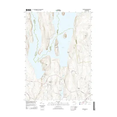
2015 Map of Winsor Dam
USGS Topo · Published 2015About this map
Winsor Dam stands as the massive structural centerpiece of this Massachusetts landscape, holding back the southern waters of the Quabbin Reservoir. The terrain is defined by the high points that escaped flooding, including Little Quabbin, Mt Lizzie, and Mt Ram, while the Calvin Coolidge Bridge provides essential transit across the inlets. To the south, the settlement pattern shifts toward the traditional centers of West Ware and Ware Center. This area illustrates the results of 20th-century water management on the local geography, where former valleys were transformed into a vast hydraulic system. Local history is preserved at the Quabbin Park Cem, while the natural drainage continues through the Swift River and smaller water bodies like Peppers Mill Pond and Beaver Lake.
Find a feature on this map
75 named features on this map. Tap any name to fly to it.
Don’t see what you’re looking for? This feature index may not catch every label — zoom into the map to look around manually.
Map Details
Editions of this 2015 Winsor Dam Map
This is the sole edition of this map. No revisions or reprints were ever made.
Other maps of this area

1887 · Brookfield
USGS Topo · 1:62,500

1887 · Palmer
USGS Topo · 1:62,500

1887 · Belchertown
USGS Topo · 1:62,500

1887 · Barre
USGS Topo · 1:62,500

1889 · Palmer
USGS Topo · 1:62,500

1889 · Barre
USGS Topo · 1:62,500

1890 · Belchertown
USGS Topo · 1:62,500

1890 · Brookfield
USGS Topo · 1:62,500

1893 · Palmer
USGS Topo · 1:62,500

1893 · Belchertown
USGS Topo · 1:62,500