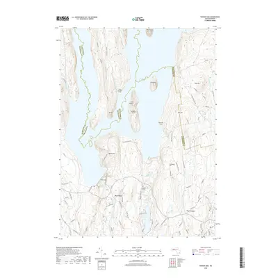
2018 Map of Winsor Dam
USGS Topo · Published 2018About this map
Winsor Dam and the expansive Quabbin Reservoir dominate this central Massachusetts landscape, where the managed waters of the Swift River valley meet the rugged uplands of the Worcester and Hampshire county borders. The map documents the engineering of the reservoir system, including the Calvin Coolidge Bridge and the cluster of islands such as Little Quabbin Island and peaks like Mt Lizzie that rise from the water.
Find a feature on this map
87 named features on this map. Tap any name to fly to it.
Don’t see what you’re looking for? This feature index may not catch every label — zoom into the map to look around manually.
Map Details
Editions of this 2018 Winsor Dam Map
This is the sole edition of this map. No revisions or reprints were ever made.
Other maps of this area

1887 · Brookfield
USGS Topo · 1:62,500

1887 · Palmer
USGS Topo · 1:62,500

1887 · Belchertown
USGS Topo · 1:62,500

1887 · Barre
USGS Topo · 1:62,500

1889 · Palmer
USGS Topo · 1:62,500

1889 · Barre
USGS Topo · 1:62,500

1890 · Belchertown
USGS Topo · 1:62,500

1890 · Brookfield
USGS Topo · 1:62,500

1893 · Palmer
USGS Topo · 1:62,500

1893 · Belchertown
USGS Topo · 1:62,500