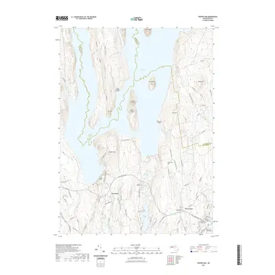
2021 Map of Winsor Dam
USGS Topo · Published 2021About this map
Quabbin Reservoir dominates the northern landscape of this region, a massive hydrological feature defining the borders of Hampshire, Franklin, and Worcester counties. The massive Winsor Dam stands as a primary engineering landmark near West-Ware, holding back the waters that submerged former valley towns. This modern survey illustrates the enduring legacy of that mid-century transformation, showing how contemporary roads like Belchertown Rd and Monson Turnpike Rd navigate the high ground around the water's edge.
Find a feature on this map
96 named features on this map. Tap any name to fly to it.
Don’t see what you’re looking for? This feature index may not catch every label — zoom into the map to look around manually.
Map Details
Editions of this 2021 Winsor Dam Map
This is the sole edition of this map. No revisions or reprints were ever made.
Other maps of this area

1887 · Brookfield
USGS Topo · 1:62,500

1887 · Palmer
USGS Topo · 1:62,500

1887 · Belchertown
USGS Topo · 1:62,500

1887 · Barre
USGS Topo · 1:62,500

1889 · Palmer
USGS Topo · 1:62,500

1889 · Barre
USGS Topo · 1:62,500

1890 · Belchertown
USGS Topo · 1:62,500

1890 · Brookfield
USGS Topo · 1:62,500

1893 · Palmer
USGS Topo · 1:62,500

1893 · Belchertown
USGS Topo · 1:62,500