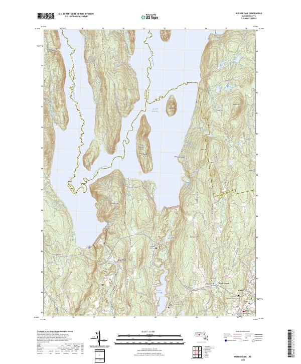
2024 Map of Winsor Dam
USGS Topo · Published 2024About this map
Quabbin Reservoir dominates this landscape, its expansive waters submerging much of the former river valley where the West Branch Swift River and East Branch Swift River once flowed. The rugged terrain rising from the shoreline features prominent elevations like Mt Lizzie, Bear Hill, and Quabbin Hill, while Little Quabbin Island remains as a peak above the current water level. To the south, the settlements of West Ware, Ware Center, and the northern edge of Ware show a concentration of civic and spiritual history through numerous burial sites.
Find a feature on this map
95 named features on this map. Tap any name to fly to it.
Don’t see what you’re looking for? This feature index may not catch every label — zoom into the map to look around manually.
Map Details
Editions of this 2024 Winsor Dam Map
This is the sole edition of this map. No revisions or reprints were ever made.
Other maps of this area

1887 · Brookfield
USGS Topo · 1:62,500

1887 · Palmer
USGS Topo · 1:62,500

1887 · Belchertown
USGS Topo · 1:62,500

1887 · Barre
USGS Topo · 1:62,500

1889 · Palmer
USGS Topo · 1:62,500

1889 · Barre
USGS Topo · 1:62,500

1890 · Belchertown
USGS Topo · 1:62,500

1890 · Brookfield
USGS Topo · 1:62,500

1893 · Palmer
USGS Topo · 1:62,500

1893 · Belchertown
USGS Topo · 1:62,500