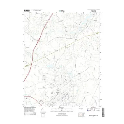
2016 Map of Winstead Crossroads
USGS Topo · Published 2016About this map
The Wilson northern suburbs and surrounding rural townships meet the Tar River in this 2016 survey of the Nash and Wilson County line. The landscape is defined by the significant hydrology of the Coastal Plain, where Toisnot Swamp and Bloomery Swamp drain southward toward the city center. Key infrastructure supporting the regional economy is visible, including the Wilson Industrial Air Center and the Rocky Mount-Wilson Regional Airport located on the northeastern edge. Older rural nodes such as Winstead Crossroads, Cliftonville, and Dunn Crossroads persist amidst modern residential expansion. Notable local landmarks like Finch Mill and the Evergreen Memorial Gardens offer specific points of interest for local researchers, while the Tar River Reservoir and Lake Wilson serve as major water features in the northern reach of the quadrangle.
Find a feature on this map
148 named features on this map. Tap any name to fly to it.
Don’t see what you’re looking for? This feature index may not catch every label — zoom into the map to look around manually.
Map Details
Editions of this 2016 Winstead Crossroads Map
This is the sole edition of this map. No revisions or reprints were ever made.
Other maps of this area

1902 · Kenly
USGS Topo · 1:62,500

1902 · Rocky Mount
USGS Topo · 1:62,500

1902 · Spring Hope
USGS Topo · 1:62,500

1903 · Kenly
USGS Topo · 1:62,500

1904 · Rocky Mount
USGS Topo · 1:62,500

1904 · Springhope
USGS Topo · 1:62,500

1904 · Wilson
USGS Topo · 1:62,500

1953 · Rocky Mount
USGS Topo · 1:250,000

1953 · Raleigh
USGS Topo · 1:250,000

1954 · Rocky Mount
USGS Topo · 1:250,000