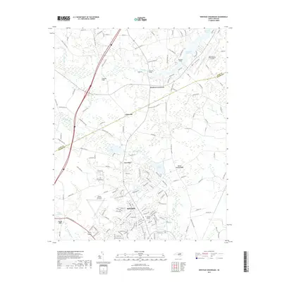
2019 Map of Winstead Crossroads
USGS Topo · Published 2019About this map
Wilson anchors the southern portion of this landscape, where the city’s industrial and residential growth meets the rural crossroads of the coastal plain. The map documents a complex drainage system defined by Toisnot Swamp and Hominy Swamp, which dictate the local topography and the placement of historic landmarks like Finch Mill and the Finch Millpond. The presence of both the Rocky Mount-Wilson Regional Airport and the Wilson Industrial Air Center underscores the area's role as a regional transportation hub during this era.
Find a feature on this map
150 named features on this map. Tap any name to fly to it.
Don’t see what you’re looking for? This feature index may not catch every label — zoom into the map to look around manually.
Map Details
Editions of this 2019 Winstead Crossroads Map
This is the sole edition of this map. No revisions or reprints were ever made.
Other maps of this area

1902 · Kenly
USGS Topo · 1:62,500

1902 · Rocky Mount
USGS Topo · 1:62,500

1902 · Spring Hope
USGS Topo · 1:62,500

1903 · Kenly
USGS Topo · 1:62,500

1904 · Rocky Mount
USGS Topo · 1:62,500

1904 · Springhope
USGS Topo · 1:62,500

1904 · Wilson
USGS Topo · 1:62,500

1953 · Rocky Mount
USGS Topo · 1:250,000

1953 · Raleigh
USGS Topo · 1:250,000

1954 · Rocky Mount
USGS Topo · 1:250,000