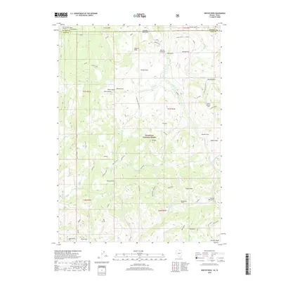
2018 Map of Winter Ridge
USGS Topo · Published 2018About this map
Humboldt National Forest spans this high-altitude landscape along the border of Nevada and Idaho, where complex drainage systems like Willis Cr and Merritt Cr carve through the terrain. The map documents an intricate network of backcountry access routes such as Dead Horse and Walker 1, which connect the high points of Winter Ridge and Pin Mtn to the basins below. This area is defined by its water sources, including Moonshine Spring and Gedney Spring, which were vital for the seasonal grazing economy. Local history is etched into the names of the gulches and flats, from the northern State Line Meadows down to the Bruneau Range. Toponyms like Yankee Bill Gulch and Deadhorse Point suggest a legacy of early prospectors and stockmen who navigated these ridges before modern conservation boundaries were established.
Find a feature on this map
65 named features on this map. Tap any name to fly to it.
Don’t see what you’re looking for? This feature index may not catch every label — zoom into the map to look around manually.
Map Details
Editions of this 2018 Winter Ridge Map
This is the sole edition of this map. No revisions or reprints were ever made.
Other maps of this area

1936 · Mountain City
USGS Topo · 1:62,500

1939 · Owyhee
USGS Topo · 1:62,500

1940 · Mountain City
USGS Topo · 1:62,500

1942 · Owyhee
USGS Topo · 1:62,500

1955 · McDermitt
USGS Topo · 1:250,000

1955 · Jordan Valley
USGS Topo · 1:250,000

1955 · Twin Falls
USGS Topo · 1:250,000

1955 · Wells
USGS Topo · 1:250,000

1957 · Jordan Valley
USGS Topo · 1:250,000

1958 · Wells
USGS Topo · 1:250,000