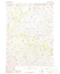
1986 Map of Winter Ridge
USGS Topo · Published 1987About this map
Humboldt National Forest spans the high terrain of this borderland area, where the high desert of the Salmon Desert meets the eastern edge of the Duck Valley Indian Reservation. The landscape is defined by its water sources and livestock history, centered on the open expanse of Willis Meadow and the secluded Horse Heaven Flat. A complex system of drainages, including Willis Creek and Log Creek, carves through the prominent spine of Winter Ridge.
Find a feature on this map
43 named features on this map. Tap any name to fly to it.
Don’t see what you’re looking for? This feature index may not catch every label — zoom into the map to look around manually.
Map Details
Editions of this 1986 Winter Ridge Map
This is the sole edition of this map. No revisions or reprints were ever made.
Other maps of this area

1936 · Mountain City
USGS Topo · 1:62,500

1939 · Owyhee
USGS Topo · 1:62,500

1940 · Mountain City
USGS Topo · 1:62,500

1942 · Owyhee
USGS Topo · 1:62,500

1955 · McDermitt
USGS Topo · 1:250,000

1955 · Jordan Valley
USGS Topo · 1:250,000

1955 · Twin Falls
USGS Topo · 1:250,000

1955 · Wells
USGS Topo · 1:250,000

1957 · Jordan Valley
USGS Topo · 1:250,000

1958 · Wells
USGS Topo · 1:250,000