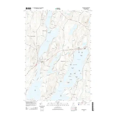
2014 Map of Winthrop
USGS Topo · Published 2014About this map
The town of Winthrop serves as a central hub in this lake-dominated landscape, situated between the expansive Maranacook Lake and the interconnected waters of Upper Narrows Pond and Lower Narrows Pond. The map reveals a high density of named family and community burial grounds, including Maple Cem, Metcalf Cem, and the Benson Family Cem, which offer significant value for genealogical research in Kennebec County. The rugged topography is defined by prominent elevations such as Sturtevant Hill and Monks Hill, which overlook a complex network of points and islands within Cobbosseecontee Lake, such as Horseshoe Island and Crams Point. This 2014 survey documents the established residential patterns in East Winthrop and Island Park, alongside the protected waters of Carleton Pond, illustrating how the region's geography has dictated local settlement and transportation routes.
Find a feature on this map
147 named features on this map. Tap any name to fly to it.
Don’t see what you’re looking for? This feature index may not catch every label — zoom into the map to look around manually.
Map Details
Editions of this 2014 Winthrop Map
This is the sole edition of this map. No revisions or reprints were ever made.
Other maps of this area

1892 · Gardiner
USGS Topo · 1:62,500

1892 · Augusta
USGS Topo · 1:62,500

1908 · Lewiston
USGS Topo · 1:62,500

1910 · Livermore
USGS Topo · 1:62,500

1912 · Livermore
USGS Topo · 1:62,500

1941 · Livermore
USGS Topo · 1:62,500

1941 · Augusta
USGS Topo · 1:62,500

1942 · Lewiston
USGS Topo · 1:62,500

1943 · Augusta
USGS Topo · 1:62,500

1943 · Gardiner
USGS Topo · 1:62,500