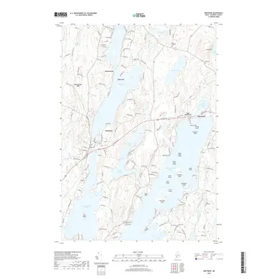
2018 Map of Winthrop
USGS Topo · Published 2018About this map
Maranacook Lake and Cobbosseecontee Lake anchor this central Maine landscape, where the town of Winthrop and smaller settlements like Tallwood and East Winthrop are defined by an intricate network of narrow ponds and wooded hills. The lake-centric geography includes Upper Narrows Pond and Lower Narrows Pond, which carve a central corridor through the terrain. Numerous islands, such as Horseshoe Island and Molazigan Island, punctuate the waters of Cobbosseecontee Lake, illustrating the complex shoreline that has long drawn seasonal and permanent residents.
Find a feature on this map
145 named features on this map. Tap any name to fly to it.
Don’t see what you’re looking for? This feature index may not catch every label — zoom into the map to look around manually.
Map Details
Editions of this 2018 Winthrop Map
This is the sole edition of this map. No revisions or reprints were ever made.
Other maps of this area

1892 · Gardiner
USGS Topo · 1:62,500

1892 · Augusta
USGS Topo · 1:62,500

1908 · Lewiston
USGS Topo · 1:62,500

1910 · Livermore
USGS Topo · 1:62,500

1912 · Livermore
USGS Topo · 1:62,500

1941 · Livermore
USGS Topo · 1:62,500

1941 · Augusta
USGS Topo · 1:62,500

1942 · Lewiston
USGS Topo · 1:62,500

1943 · Augusta
USGS Topo · 1:62,500

1943 · Gardiner
USGS Topo · 1:62,500