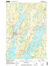
2000 Map of Winthrop
USGS Topo · Published 2001About this map
Cobbosseecontee Lake dominates the southeastern portion of this Kennebec County survey, its intricate shoreline defined by places like Wings Sound, Deadmans Cove, and Horseshoe Island. The landscape is a complex network of glacial ponds and narrow waterways, including Maranacook Lake, Upper Narrows Pond, and Lower Narrows Pond, which separate the primary settlement at Winthrop from the outlying hills.
Find a feature on this map
86 named features on this map. Tap any name to fly to it.
Don’t see what you’re looking for? This feature index may not catch every label — zoom into the map to look around manually.
Map Details
Editions of this 2000 Winthrop Map
This is the sole edition of this map. No revisions or reprints were ever made.
Other maps of this area

1892 · Gardiner
USGS Topo · 1:62,500

1892 · Augusta
USGS Topo · 1:62,500

1908 · Lewiston
USGS Topo · 1:62,500

1910 · Livermore
USGS Topo · 1:62,500

1912 · Livermore
USGS Topo · 1:62,500

1941 · Livermore
USGS Topo · 1:62,500

1941 · Augusta
USGS Topo · 1:62,500

1942 · Lewiston
USGS Topo · 1:62,500

1943 · Augusta
USGS Topo · 1:62,500

1943 · Gardiner
USGS Topo · 1:62,500