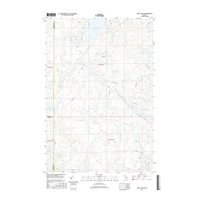
2017 Map of Witch Lake NE
USGS Topo · Published 2017About this map
The southern reaches of Lake Michigamme and the serpentine Michigamme River dominate this portion of the Upper Peninsula, marking the convergence of Baraga, Marquette, and Iron Counties. This landscape is defined by its complex hydrology, where the Spruce River joins the main river system amidst a network of smaller water bodies like Dashwa Lake and Horseshoe Lake. The drainage patterns here, including Trout Falls Cr, illustrate the glacial topography of the region.
Find a feature on this map
42 named features on this map. Tap any name to fly to it.
Don’t see what you’re looking for? This feature index may not catch every label — zoom into the map to look around manually.
Map Details
Editions of this 2017 Witch Lake NE Map
This is the sole edition of this map. No revisions or reprints were ever made.
Other maps of this area

1899 · Witbeck
USGS Topo · 1:62,500

1955 · Champion
USGS Topo · 1:24,000

1955 · Witch Lake
USGS Topo · 1:24,000

1955 · Witch Lake NE
USGS Topo · 1:24,000

1955 · Republic
USGS Topo · 1:62,500

1955 · Republic
USGS Topo · 1:24,000

1955 · Witch Lake
USGS Topo · 1:62,500

1955 · Republic SW
USGS Topo · 1:24,000

1955 · Champion
USGS Topo · 1:62,500

1956 · Three Lakes
USGS Topo · 1:24,000
Featured Places
- Spurr Township, MI
- Republic Township, MI
- Crystal Falls Township, MI
- Marquette County, MI
- Baraga County, MI