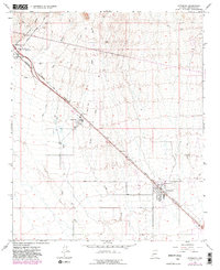
1965 Map of Wittmann
USGS Topo · Published 1982About this map
The Atchison Topeka and Santa Fe railroad corridor cuts a sharp diagonal through this desert landscape, anchoring the development of several roadside and rail-oriented communities. Near the center of the sheet, Circle City appears alongside a Trailer Park and Water Tank, illustrating the mid-century growth of small desert settlements. Further southeast, the town of Wittmann is plotted with its residential grid and the Nadaburg Sch, while Morristown and the Castle Hot Springs Station occupy the northwest corner.
Find a feature on this map
21 named features on this map. Tap any name to fly to it.
Don’t see what you’re looking for? This feature index may not catch every label — zoom into the map to look around manually.
Map Details
Editions of this 1965 Wittmann Map
4 editions found
Other maps of this area

1954 · Phoenix
USGS Topo · 1:250,000

1957 · Phoenix
USGS Topo · 1:250,000

1957 · White Tank Mts. NE
USGS Topo · 1:24,000

1957 · McMicken Dam
USGS Topo · 1:24,000

1957 · White Tank Mts.
USGS Topo · 1:62,500

1958 · Phoenix
USGS Topo · 1:250,000

1960 · Phoenix
USGS Topo · 1:250,000
1964 · Garfias Mountain
USGS Topo · 1:24,000
1964 · Wickenburg
USGS Topo · 1:24,000
1964 · Red Picacho
USGS Topo · 1:24,000