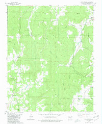
1980 Map of Witts Springs
USGS Topo · Published 1981About this map
Witts Springs and the surrounding highlands of Searcy County are defined by a complex network of ridges and hollows within the Ozark National Forest. In the late 1970s, this area remained characterized by small, dispersed settlements and a landscape shaped by narrow watercourses like Lick Fork Creek and Bear Creek. The community of Welcome Home and the settlement at Imo represent the enduring rural footprint of the region, where life followed the contours of Giles Turney Ridge and Bradley Ridge. Local landmarks such as Pleasant Grove Ch and the Chinquapin Cem provide significant touchpoints for genealogical research, while the presence of a Gravel Pit and a Quarry indicate the localized extraction of resources. The map captures the transition from high points like Lick Owens Mountain and Housley Mountain down into deep drainages such as Sulphur Springs Hollow and Wassen Hollow.
Find a feature on this map
34 named features on this map. Tap any name to fly to it.
Don’t see what you’re looking for? This feature index may not catch every label — zoom into the map to look around manually.
Map Details
Editions of this 1980 Witts Springs Map
This is the sole edition of this map. No revisions or reprints were ever made.
Other maps of this area

1879 · Washington
USGS Topo · 1:62,500

1887 · Smyrna
USGS Topo · 1:62,500

1889 · Marshall #3
USGS Topo · 1:62,500

1892 · Marshall
USGS Topo · 1:125,000

1894 · Marshall
USGS Topo · 1:125,000

1901 · Marshall
USGS Topo · 1:125,000

1939 · Snowball
USGS Topo · 1:62,500

1940 · Smyrna
USGS Topo · 1:62,500

1941 · Snowball
USGS Topo · 1:62,500

1942 · Snowball
USGS Topo · 1:62,500