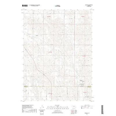
2017 Map of Wolbach
USGS Topo · Published 2017About this map
Wolbach and the surrounding agricultural lands of the Sandhills transition zone define this portion of central Nebraska along the border of Greeley and Howard counties. The settlement of Wolbach is the primary hub, featuring a concentrated grid including Center St, Greeley Ave, and the local Po. To the north, the smaller community of Brayton sits along the W Br Spring Cr, illustrating the typical pattern of rail-era Nebraska towns spaced along the drainage systems. The landscape is carved by the complex fingers of Spring Cr and its western branch, which create the undulating topography that dominates the quadrangle. Genealogists and local historians can locate Wolbach Cem near the town center, while the Summit Cem provides a significant historical anchor to the southwest. Water management in this semi-arid region is represented by features like Stone Reservoir, which supports the surrounding farmsteads linked by a network of sectional roads such as Brayton Rd and 800 Rd.
Find a feature on this map
25 named features on this map. Tap any name to fly to it.
Don’t see what you’re looking for? This feature index may not catch every label — zoom into the map to look around manually.
Map Details
Editions of this 2017 Wolbach Map
This is the sole edition of this map. No revisions or reprints were ever made.
Other maps of this area

1899 · Loup
USGS Topo · 1:125,000

1899 · St. Paul
USGS Topo · 1:125,000

1953 · Scotia NE
USGS Topo · 1:24,000

1953 · Elba
USGS Topo · 1:24,000

1954 · Greeley
USGS Topo · 1:24,000

1954 · Spalding SW
USGS Topo · 1:24,000

1954 · Wolbach
USGS Topo · 1:24,000

1954 · Wolbach NE
USGS Topo · 1:24,000

1954 · Spalding SE
USGS Topo · 1:24,000

1955 · Broken Bow
USGS Topo · 1:250,000