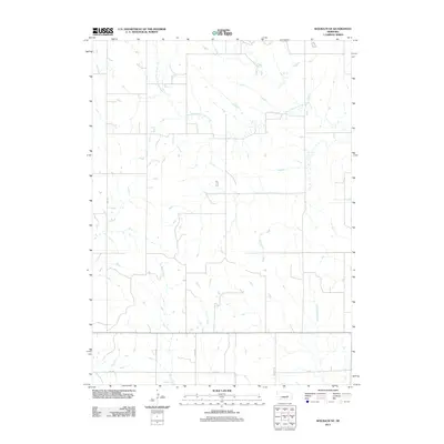
2011 Map of Wolbach NE
USGS Topo · Published 2011About this map
South Branch Timber Creek meanders through the northern reaches of this Merrick County landscape, defining the local drainage patterns alongside Rock Creek and Cottonwood Creek. The area is organized by a precise grid of rural thoroughfares, including names that reflect local history and planning such as WPA Ave, Brady Rd, and Cody Rd. This 2011 survey by the Usgs illustrates the persistent agrarian character of the Nebraska plains, where the intersection of Merrick Rd and 24th Ave serves as a waypoint in a landscape largely dedicated to open fields. The presence of FF Rd and other designated routes highlights the modern infrastructure laid over the traditional township and range system, providing a clear view of the region's geographic layout in the early twenty-first century.
Find a feature on this map
9 named features on this map. Tap any name to fly to it.
Don’t see what you’re looking for? This feature index may not catch every label — zoom into the map to look around manually.
Map Details
Editions of this 2011 Wolbach NE Map
This is the sole edition of this map. No revisions or reprints were ever made.
Other maps of this area

1899 · St. Paul
USGS Topo · 1:125,000

1954 · Cedar Rapids
USGS Topo · 1:24,000

1954 · Spalding SW
USGS Topo · 1:24,000

1954 · Wolbach
USGS Topo · 1:24,000

1954 · Wolbach NE
USGS Topo · 1:24,000

1954 · Belgrade NW
USGS Topo · 1:24,000

1954 · Spalding SE
USGS Topo · 1:24,000

1955 · Belgrade SW
USGS Topo · 1:24,000

1955 · Broken Bow
USGS Topo · 1:250,000

1955 · Wolbach SW
USGS Topo · 1:24,000