
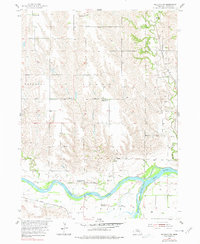
1955 Map of Wolbach SW
USGS Topo · Published 1956About this map
The North Loup River and Middle Loup River converge in this mid-century survey of Howard County, illustrating the hydraulic and agricultural character of the Nebraska landscape. The map captures a period of consolidation in rural education, marking several active district locations such as School No 56 and School No 21, while simultaneously identifying others like School No 33 (Abandoned) that had already ceased operation.
Find a feature on this map
25 named features on this map. Tap any name to fly to it.
Don’t see what you’re looking for? This feature index may not catch every label — zoom into the map to look around manually.
Map Details
Editions of this 1955 Wolbach SW Map
2 editions found
Other maps of this area

1899 · Loup
USGS Topo · 1:125,000

1899 · St. Paul
USGS Topo · 1:125,000

1953 · Scotia NE
USGS Topo · 1:24,000

1953 · Nysted
USGS Topo · 1:24,000

1953 · Elba
USGS Topo · 1:24,000

1954 · Wolbach
USGS Topo · 1:24,000

1954 · Wolbach NE
USGS Topo · 1:24,000

1955 · Broken Bow
USGS Topo · 1:250,000

1955 · Cushing
USGS Topo · 1:24,000

1956 · Broken Bow
USGS Topo · 1:250,000