
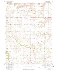
1953 Map of Nysted
USGS Topo · Published 1955About this map
Farwell (Posen) and Nysted anchor this mid-century portrait of Howard County, where the landscape is defined by the winding course of the Middle Loup River and its various tributaries. The map captures an era of dense rural infrastructure, shown through a prolific system of country schools like School No 18 and School No 55. This detailed survey was produced as part of the Department of the Interior program for the development of the Missouri River Basin, reflecting a period of active land and water management.
Find a feature on this map
27 named features on this map. Tap any name to fly to it.
Don’t see what you’re looking for? This feature index may not catch every label — zoom into the map to look around manually.
Map Details
Editions of this 1953 Nysted Map
2 editions found
Other maps of this area

1899 · Loup
USGS Topo · 1:125,000

1899 · St. Paul
USGS Topo · 1:125,000

1953 · Dannebrog
USGS Topo · 1:24,000

1953 · Cotesfield
USGS Topo · 1:24,000

1953 · Boelus
USGS Topo · 1:24,000

1953 · Farwell
USGS Topo · 1:24,000

1953 · Elba
USGS Topo · 1:24,000

1955 · Broken Bow
USGS Topo · 1:250,000

1955 · Wolbach SW
USGS Topo · 1:24,000

1956 · Broken Bow
USGS Topo · 1:250,000