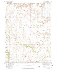
1953 Map of Nysted
USGS Topo · Published 1978About this map
Farwell (Posen) and the smaller hamlet of Nysted anchor this mid-century portrait of Howard County, Nebraska, where the agricultural landscape is divided into the townships of Posen, Warsaw, and Dannebrog. The region is defined by its diverse immigrant heritage, preserved on the map through numerous burial grounds including the Czechoslovakia Cem, St Wenceslaus Cem, and Scotch Cem. These sites, along with rural landmarks like School No 18 and School No 13, illustrate the dispersed pattern of early prairie settlement. The physical geography is dominated by the meandering course of Turkey Creek and the Middle Loup River in the southeast, while the Burlington Northern and Union Pacific railroads mark the transportation corridors that historically connected these farming communities to wider markets.
Find a feature on this map
24 named features on this map. Tap any name to fly to it.
Don’t see what you’re looking for? This feature index may not catch every label — zoom into the map to look around manually.
Map Details
Editions of this 1953 Nysted Map
2 editions found
Other maps of this area

1899 · Loup
USGS Topo · 1:125,000

1899 · St. Paul
USGS Topo · 1:125,000

1953 · Dannebrog
USGS Topo · 1:24,000

1953 · Cotesfield
USGS Topo · 1:24,000

1953 · Boelus
USGS Topo · 1:24,000

1953 · Farwell
USGS Topo · 1:24,000

1953 · Nysted
USGS Topo · 1:24,000

1953 · Elba
USGS Topo · 1:24,000

1955 · Broken Bow
USGS Topo · 1:250,000

1955 · Wolbach SW
USGS Topo · 1:24,000