
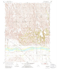
1955 Map of Cushing
USGS Topo · Published 1956About this map
The settlement of Cushing sits as a primary rail point along the Chicago Burlington and Quincy railroad, which cuts a straight line through the river bottomlands of Gage Valley. This mid-century survey by the Geological Survey and U.S. Bureau of Reclamation highlights the intricate hydrology of the Loup River, where braided channels and sandbars define the landscape south of the town. To the north, the terrain transitions into a series of dissected hills drained by Cottonwood Creek and Rock Creek.
Find a feature on this map
19 named features on this map. Tap any name to fly to it.
Don’t see what you’re looking for? This feature index may not catch every label — zoom into the map to look around manually.
Map Details
Editions of this 1955 Cushing Map
2 editions found
Other maps of this area

1899 · St. Paul
USGS Topo · 1:125,000

1954 · Wolbach
USGS Topo · 1:24,000

1954 · Wolbach NE
USGS Topo · 1:24,000

1954 · Belgrade NW
USGS Topo · 1:24,000

1955 · Belgrade SW
USGS Topo · 1:24,000

1955 · Broken Bow
USGS Topo · 1:250,000

1955 · Wolbach SW
USGS Topo · 1:24,000

1956 · Broken Bow
USGS Topo · 1:250,000
1960 · St. Paul
USGS Topo · 1:24,000
1961 · Palmer
USGS Topo · 1:24,000