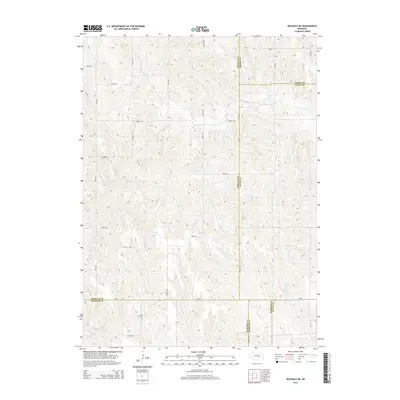
2014 Map of Wolbach NE
USGS Topo · Published 2014About this map
S Br Timber Cr and Cottonwood Cr flow through this section of the Nebraska interior, where the borders of five counties—Greeley, Boone, Nance, Howard, and Merrick—converge. The landscape is defined by a dense grid of rural corridors, including the long-reaching Brady Rd and Wpa Ave, which testify to the systematic organization of the region's agricultural heartland. Unlike many surrounding areas defined by dense settlements, this quadrangle highlights the intersection of local transit and natural drainage systems. State route Ne-22 provides a primary east-west artery across the southern portion of the map, while secondary routes like Merrick Rd and 804th Rd connect isolated homesteads. The terrain is marked by the subtle draws and rises of the Platte River watershed, captured here at a moment when traditional rural infrastructure remained the primary footprint upon the land.
Find a feature on this map
30 named features on this map. Tap any name to fly to it.
Don’t see what you’re looking for? This feature index may not catch every label — zoom into the map to look around manually.
Map Details
Editions of this 2014 Wolbach NE Map
This is the sole edition of this map. No revisions or reprints were ever made.
Other maps of this area

1899 · St. Paul
USGS Topo · 1:125,000

1954 · Cedar Rapids
USGS Topo · 1:24,000

1954 · Spalding SW
USGS Topo · 1:24,000

1954 · Wolbach
USGS Topo · 1:24,000

1954 · Wolbach NE
USGS Topo · 1:24,000

1954 · Belgrade NW
USGS Topo · 1:24,000

1954 · Spalding SE
USGS Topo · 1:24,000

1955 · Belgrade SW
USGS Topo · 1:24,000

1955 · Broken Bow
USGS Topo · 1:250,000

1955 · Wolbach SW
USGS Topo · 1:24,000