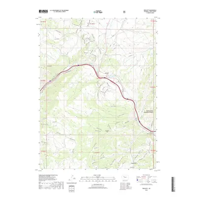
2019 Map of Wolcott
USGS Topo · Published 2019About this map
The Eagle River carves a central path through this section of Eagle County, anchoring the settlement of Wolcott and the nearby Eagle Valley. The landscape is defined by its complex water management and high-altitude terrain, featuring the Leonard Horn Ditch Number 1 and Sherwood Ditch systems alongside several upland water sources like Spalding Reservoir and Alex Spring Reservoir. These irrigation networks supported the agricultural and ranching efforts common in this part of Colorado.
Find a feature on this map
83 named features on this map. Tap any name to fly to it.
Don’t see what you’re looking for? This feature index may not catch every label — zoom into the map to look around manually.
Map Details
Editions of this 2019 Wolcott Map
This is the sole edition of this map. No revisions or reprints were ever made.
Other maps of this area

1957 · Leadville
USGS Topo · 1:250,000

1959 · Leadville
USGS Topo · 1:250,000

1960 · Leadville
USGS Topo · 1:250,000

1962 · Leadville
USGS Topo · 1:250,000

1962 · Grouse Mountain
USGS Topo · 1:24,000

1962 · Fulford
USGS Topo · 1:24,000

1962 · Wolcott
USGS Topo · 1:24,000

1962 · Eagle
USGS Topo · 1:24,000

1962 · Edwards
USGS Topo · 1:24,000
1962 · The Seven Hermits
USGS Topo · 1:24,000