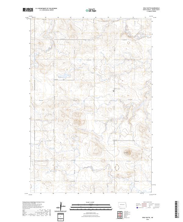
2024 Map of Wolf Butte
USGS Topo · Published 2024About this map
Wolf Butte rises above the rolling grasslands of Adams County, serving as a primary landmark in this sparsely populated region of North Dakota. The landscape is defined by the ephemeral drainage of Duck Creek and Wolf Butte Creek, alongside the wetland area of Russian Slough to the northwest. This modern survey reflects the enduring agricultural character of the high plains, where the rectilinear grid of township lines and local roads like 18th Ave NE and 11th St NW partition the land into large sections. A central point of community history is the Wolf Butte Lutheran Cem, a quiet site that indicates the early 20th-century settlement patterns of the surrounding prairie. The map provides a clear view of the hydrological network and the isolated topographical features that guided early travelers and homesteaders across this northern frontier.
Find a feature on this map
23 named features on this map. Tap any name to fly to it.
Don’t see what you’re looking for? This feature index may not catch every label — zoom into the map to look around manually.
Map Details
Editions of this 2024 Wolf Butte Map
This is the sole edition of this map. No revisions or reprints were ever made.
Other maps of this area

1953 · Dickinson
USGS Topo · 1:250,000

1957 · Dickinson
USGS Topo · 1:250,000

1969 · Reeder
USGS Topo · 1:24,000

1973 · Liens Dams
USGS Topo · 1:24,000

1973 · Cedar Lake
USGS Topo · 1:24,000

1973 · Enterprise School
USGS Topo · 1:24,000

1974 · Hettinger North
USGS Topo · 1:24,000

1980 · Mott
USGS Topo · 1:100,000
2011 · Enterprise School
USGS Topo · 1:24,000
2011 · Reeder
USGS Topo · 1:24,000