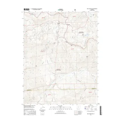
2016 Map of Wolf Creek Pass
USGS Topo · Published 2016About this map
Wolf Creek Pass serves as the central high-altitude crossing of the San Juan Mountains, where the boundary between the Rio Grande National Forest and San Juan National Forest meets at the continental crest. This 2016 survey highlights a landscape dominated by the Continental Divide National Scenic Trail, which threads through prominent peaks including Alberta Peak and Treasure Mtn. The hydrology is defined by the headwaters of the E Fork San Juan River and several alpine water bodies like Rock Lake and the Alberta Park Reservoir. Significant landmarks such as Treasure Falls and Windy Pass are clearly marked alongside an extensive network of high-country routes including the Lobo Trail and Treasure Mountain Trail. The map also captures the administrative division at the Mineral Co Archuleta Co line, providing a detailed record of this high-elevation pass before modern forest management updates.
Find a feature on this map
41 named features on this map. Tap any name to fly to it.
Don’t see what you’re looking for? This feature index may not catch every label — zoom into the map to look around manually.
Map Details
Editions of this 2016 Wolf Creek Pass Map
This is the sole edition of this map. No revisions or reprints were ever made.
Other maps of this area

1913 · Summitville
USGS Topo · 1:125,000

1914 · Creede
USGS Topo · 1:125,000

1915 · Summitville
USGS Topo · 1:125,000

1916 · Creede
USGS Topo · 1:125,000

1945 · Durango
USGS Topo · 1:250,000

1953 · Durango
USGS Topo · 1:250,000

1954 · Durango
USGS Topo · 1:250,000

1957 · Wolf Creek Pass
USGS Topo · 1:62,500

1957 · Spar City
USGS Topo · 1:62,500

1961 · Durango
USGS Topo · 1:250,000