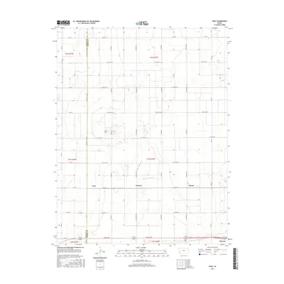
2015 Map of Wolf
USGS Topo · Published 2015About this map
The agricultural landscape of Western Kansas is defined by the critical irrigation infrastructure found near Wolf, where the Great Eastern Ditch and Farmers Ditch traverse the southern portion of the quadrangle. These water features, essential for the region's farming economy, run parallel to major local thoroughfares like Bookover Rd. The map illustrates a strictly organized section-line grid system, where settlements such as Peterson and Ritchal sit along W Lowe Rd, marking a sparse but persistent pattern of habitation. The Kearny Co Finney Co line bisects the western edge, showing how political boundaries intersect with the geometric precision of the Great Plains. To the southeast, the area transitions toward Holcomb, providing a detailed look at the rural road network including W Rodkey Rd and various numbered county routes.
Find a feature on this map
32 named features on this map. Tap any name to fly to it.
Don’t see what you’re looking for? This feature index may not catch every label — zoom into the map to look around manually.
Map Details
Editions of this 2015 Wolf Map
This is the sole edition of this map. No revisions or reprints were ever made.
Other maps of this area

1891 · Larned
USGS Topo · 1:125,000

1896 · Garden
USGS Topo · 1:125,000

1900 · Lakin
USGS Topo · 1:125,000

1944 · Tennis
USGS Topo · 1:62,500

1955 · Dodge City
USGS Topo · 1:250,000

1955 · Scott City
USGS Topo · 1:250,000

1958 · Dodge City
USGS Topo · 1:250,000

1958 · Scott City
USGS Topo · 1:250,000

1959 · Dodge City
USGS Topo · 1:250,000

1960 · Deerfield
USGS Topo · 1:24,000