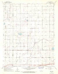
1965 Map of Wolf
USGS Topo · Published 1967About this map
The Garden City Western railroad forms a clear east-west corridor across this landscape, connecting the small settlements of Wolf, Petersen, and Ritchal. This infrastructure reflects the agricultural and industrial organization of the mid-1960s, where rail access was central to moving goods through the western plains. The terrain is divided into distinct named areas like Sherlock, Terry, and East Hibbard, while the boundary between Kearny and Finney Counties bisects the western half of the map.
Find a feature on this map
15 named features on this map. Tap any name to fly to it.
Don’t see what you’re looking for? This feature index may not catch every label — zoom into the map to look around manually.
Map Details
Editions of this 1965 Wolf Map
This is the sole edition of this map. No revisions or reprints were ever made.
Other maps of this area

1891 · Larned
USGS Topo · 1:125,000

1896 · Garden
USGS Topo · 1:125,000

1900 · Lakin
USGS Topo · 1:125,000

1944 · Tennis
USGS Topo · 1:62,500

1955 · Dodge City
USGS Topo · 1:250,000

1955 · Scott City
USGS Topo · 1:250,000

1958 · Dodge City
USGS Topo · 1:250,000

1958 · Scott City
USGS Topo · 1:250,000

1959 · Dodge City
USGS Topo · 1:250,000

1960 · Deerfield
USGS Topo · 1:24,000