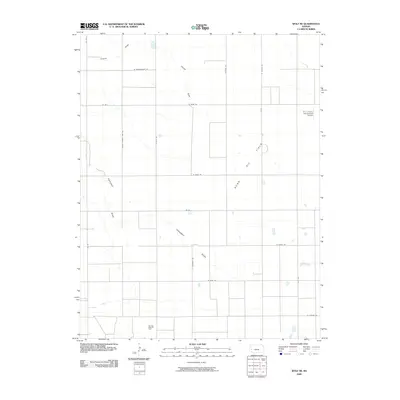
2009 Map of Wolf NE
USGS Topo · Published 2009About this map
Extensive oil and gas infrastructure defines this Western Kansas landscape, dominated by the Nunn Oil Field and the Amazon Ditch Oil Field in the southern portion of the quadrangle. The terrain is characterized by an orderly grid of section roads and several intermittent drainage features, most notably Crozier Draw in the north and Campbell Draw crossing the central region. These seasonal waterways provide the primary topographical variation in an otherwise flat, agricultural expanse.
Find a feature on this map
20 named features on this map. Tap any name to fly to it.
Don’t see what you’re looking for? This feature index may not catch every label — zoom into the map to look around manually.
Map Details
Editions of this 2009 Wolf NE Map
This is the sole edition of this map. No revisions or reprints were ever made.
Other maps of this area

1940 · Scott City
USGS Topo · 1:62,500

1941 · Modoc
USGS Topo · 1:62,500

1944 · Tennis
USGS Topo · 1:62,500

1951 · Scott City
USGS Topo · 1:62,500

1951 · Modoc
USGS Topo · 1:62,500

1955 · Scott City
USGS Topo · 1:250,000

1958 · Scott City
USGS Topo · 1:250,000
1965 · Wolf
USGS Topo · 1:24,000

1965 · Wolf NW
USGS Topo · 1:24,000

1965 · Wolf NE
USGS Topo · 1:24,000