
1965 Map of Wolf NE
USGS Topo · Published 1967About this map
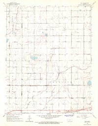
The East Hubbard Field dominates this Kansas landscape, reflecting the mid-1960s energy development across the border of Kearny and Finney counties. The terrain is defined by dry drainage systems including Crozier Draw and Campbell Draw, while the southern portion of the sheet shows the engineered irrigation efforts of the Amazon Ditch. This era was marked by a dense network of industrial activity, with dozens of sites labeled as Gas Wells, Oil Wells, and several water Wells. The infrastructure supporting this extraction is visible through multiple pipelines that cut across the section lines. Near the center of the survey, a Radio Tower stands as a distinct navigation point in a region otherwise characterized by vast agricultural field lines and the rolling topography of the High Plains.
Find a feature on this map
13 named features on this map. Tap any name to fly to it.
Don’t see what you’re looking for? This feature index may not catch every label — zoom into the map to look around manually.
Map Details
Editions of this 1965 Wolf NE Map
This is the sole edition of this map. No revisions or reprints were ever made.
Other maps of this area

1940 · Scott City
USGS Topo · 1:62,500

1941 · Modoc
USGS Topo · 1:62,500

1944 · Tennis
USGS Topo · 1:62,500

1951 · Scott City
USGS Topo · 1:62,500

1951 · Modoc
USGS Topo · 1:62,500

1955 · Scott City
USGS Topo · 1:250,000

1958 · Scott City
USGS Topo · 1:250,000
1965 · Wolf
USGS Topo · 1:24,000

1965 · Wolf NW
USGS Topo · 1:24,000
1966 · Wolf SW
USGS Topo · 1:24,000