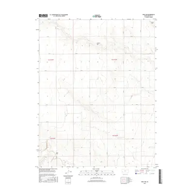
2015 Map of Wolf NW
USGS Topo · Published 2015About this map
Campbell Draw and James Draw define the topography of this Kearny County landscape, illustrating the ephemeral drainage patterns characteristic of the high plains. This 2015 survey by the U.S. Geological Survey shows a strictly gridded agricultural region partitioned by an extensive network of county roads. The dominance of the Public Land Survey System is evident in the layout of Co Rd R and Co Rd 7, which follow section lines across t21s r36w and adjacent townships.
Find a feature on this map
20 named features on this map. Tap any name to fly to it.
Don’t see what you’re looking for? This feature index may not catch every label — zoom into the map to look around manually.
Map Details
Editions of this 2015 Wolf NW Map
This is the sole edition of this map. No revisions or reprints were ever made.
Other maps of this area

1941 · Modoc
USGS Topo · 1:62,500

1951 · Modoc
USGS Topo · 1:62,500

1955 · Scott City
USGS Topo · 1:250,000

1958 · Scott City
USGS Topo · 1:250,000
1965 · Wolf
USGS Topo · 1:24,000

1965 · Leoti 3 NE
USGS Topo · 1:24,000

1965 · Wolf NW
USGS Topo · 1:24,000

1965 · Wolf NE
USGS Topo · 1:24,000
1966 · Wolf SW
USGS Topo · 1:24,000
1966 · Leoti 3 SE
USGS Topo · 1:24,000