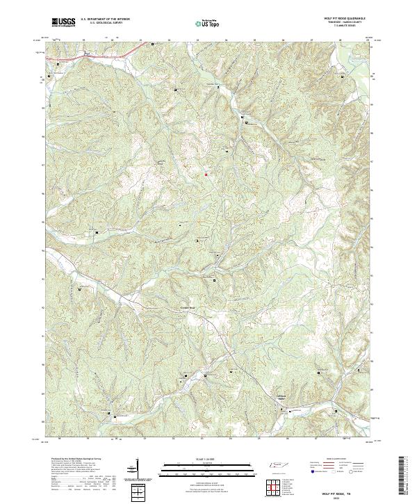
2022 Map of Wolf Pit Ridge
USGS Topo · Published 2022About this map
Gillises Mills and Center Star anchor this rural landscape in southeastern Tennessee, where deep hollows and narrow ridges dictate the patterns of settlement. The terrain is defined by a dense network of drainages like Horse Cr and Turkey Cr, which have carved out named landforms such as White Hollow and Baugus Hollow. For genealogists and local historians, this map is particularly valuable for its high density of family burial grounds, including the Smith-Rose Cem, Lacefield Cem, and Wilkerson Cem. These sites, often situated on high ground or at the head of hollows like Mozier Mill Hollow, suggest the lineage of early families who farmed these ridges. The namesake Wolf Pit Ridge stands as a central topographic landmark, surrounded by a complex web of local roads such as Rochelle Farm Rd and Lonesome Pine Rd that follow the natural contours of the Hardin County hills.
Find a feature on this map
106 named features on this map. Tap any name to fly to it.
Don’t see what you’re looking for? This feature index may not catch every label — zoom into the map to look around manually.
Map Details
Editions of this 2022 Wolf Pit Ridge Map
This is the sole edition of this map. No revisions or reprints were ever made.
Other maps of this area

1905 · Waynesboro
USGS Topo · 1:125,000

1936 · Savannah
USGS Topo · 1:24,000

1936 · Wolf Pit Ridge
USGS Topo · 1:24,000

1936 · Hookers Bend
USGS Topo · 1:24,000

1936 · Eagle Creek
USGS Topo · 1:24,000

1936 · Olivehill
USGS Topo · 1:24,000

1936 · Pickwick
USGS Topo · 1:24,000

1936 · Ransom Stand
USGS Topo · 1:24,000

1936 · Lowryville
USGS Topo · 1:24,000

1936 · Martins Mills
USGS Topo · 1:24,000