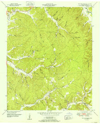
1952 Map of Wolf Pit Ridge
USGS Topo · Published 1952About this map
Gillises Mills and the surrounding Hardin County highlands are defined by an intricate network of hollows and ridges during this post-war era. The landscape is marked by small upland communities and family landmarks, with Center Star and Todd serving as local anchor points. Transport is dominated by winding creek-side tracks and the notable Pinhook Road, which traverses the ridge lines above Turkey Creek.
Find a feature on this map
87 named features on this map. Tap any name to fly to it.
Don’t see what you’re looking for? This feature index may not catch every label — zoom into the map to look around manually.
Map Details
Editions of this 1952 Wolf Pit Ridge Map
This is the sole edition of this map. No revisions or reprints were ever made.
Other maps of this area

1905 · Waynesboro
USGS Topo · 1:125,000

1936 · Savannah
USGS Topo · 1:24,000

1936 · Wolf Pit Ridge
USGS Topo · 1:24,000

1936 · Hookers Bend
USGS Topo · 1:24,000

1936 · Eagle Creek
USGS Topo · 1:24,000

1936 · Olivehill
USGS Topo · 1:24,000

1936 · Pickwick
USGS Topo · 1:24,000

1936 · Ransom Stand
USGS Topo · 1:24,000

1936 · Lowryville
USGS Topo · 1:24,000

1936 · Martins Mills
USGS Topo · 1:24,000